Madrid, the biggest city in Spain, might not seem like a great hiking destination at first sight. Of course, it is a busy city with soooo many people, traffic, and noise. But, when you look at the surroundings of Madrid, you can find some amazing hiking destinations! Madrid is surrounded by some very beautiful nature, beautiful forests. So if you ever want to go hiking near Madrid you came to the right place. I challenge you to take the time and catch a train to go to the outskirts of Madrid to experience untouched nature, incredible viewpoints and maybe you will even be able to see snow! In this blog post, I write about seven popular hiking routes close to Madrid that I recommend to you. And it gets even better: You can reach (almost) all of them by public transport.
Are you looking for more information about visiting Madrid? Check out the following blog posts:
A self-guided walking tour of Madrid
In case you still have energy after these hikes you can do this self-guided walking tour of Madrid. It includes the most important attractions and food spots in Madrid. So that you can see the most important parts of Madrid in only one afternoon!
A 2-day itinerary for visiting Madrid
Are you in Madrid for the weekend? Check out this itinerary I planned for staying in Madrid for two days. It includes the best attractions, museums, and even rooftop bars. I made sure to include some local tips and recommendations as well.
More than 100 cheap or free things you can do in Madrid
Yes, you read right. This blog post includes 104 cheap or free things you can do in Madrid. This is the ultimate low-budget guide for Madrid and includes free museums, parks, attractions and so much more!
What you should know before going hiking near Madrid:
Should I go by public transport or by car?
Let’s start with good news: There are hiking trails where you do not need a car to get there. Public transport in Madrid is really great. Even if you are going into the outskirts, most of the time there is an option to get there by train or bus. Of course, if you want to go to more remote areas I would recommend renting a car. Especially, if you’d like to go on longer hikes, or even want to stay the night at some places. There are some amazing places in the outskirts of Madrid, where staying the night is recommended.
What about renting a car?
When renting a car, I can recommend checking availabilities and prices on rentalcars.com. I found them to be much cheaper than renting a car from one of the companies at the airport in Madrid. Apart from that, there are several locations where you can pick up your car in Madrid, like Atocha or the Station in Chamartín. So you do not have to go to the airport in order to pick up your rental car. To me, this seems like the easiest option when renting a car in Spain.
Must-haves for your backpack: sunscreen and water
If you happen to be in Madrid during the warmer months you probably already have realized how hot it can get during the summer. And it’s no joke! Even though you might think it will not be as cold in the higher altitudes, you should ALWAYS bring sunscreen when going hiking near Madrid. Even, if you are wearing a jacket.
Another important thing is water and snacks. Especially now, during the pandemic smaller shops and supermarkets in remote areas are not always open. And Google Maps is not always reliable. Bring enough water when going for a hike.
Maps with detailed instructions of all hikes near Madrid in this blog post
At each hiking destination, I included a map with a recommended itinerary. If you click on the three dots on the top right corner you can send this map to your e-mail address. This way, you can upload it on your phone and use it during your hike. I don’t want you to get lost in the middle of nowhere! ;-)
So, if you want to go on one of these hikes, make sure to download or check the maps attached for viewpoints, paths, and important destinations during your hike.
Hike close to Madrid: Circular Casa de Campo
Length of the hike: 7-17 km (I marked the short version of the hike on the map, but you can decide to make it much longer if you take the ways that would increase the circular route)
Difficulty: 2/10, Casa de Campo is very family-friendly!
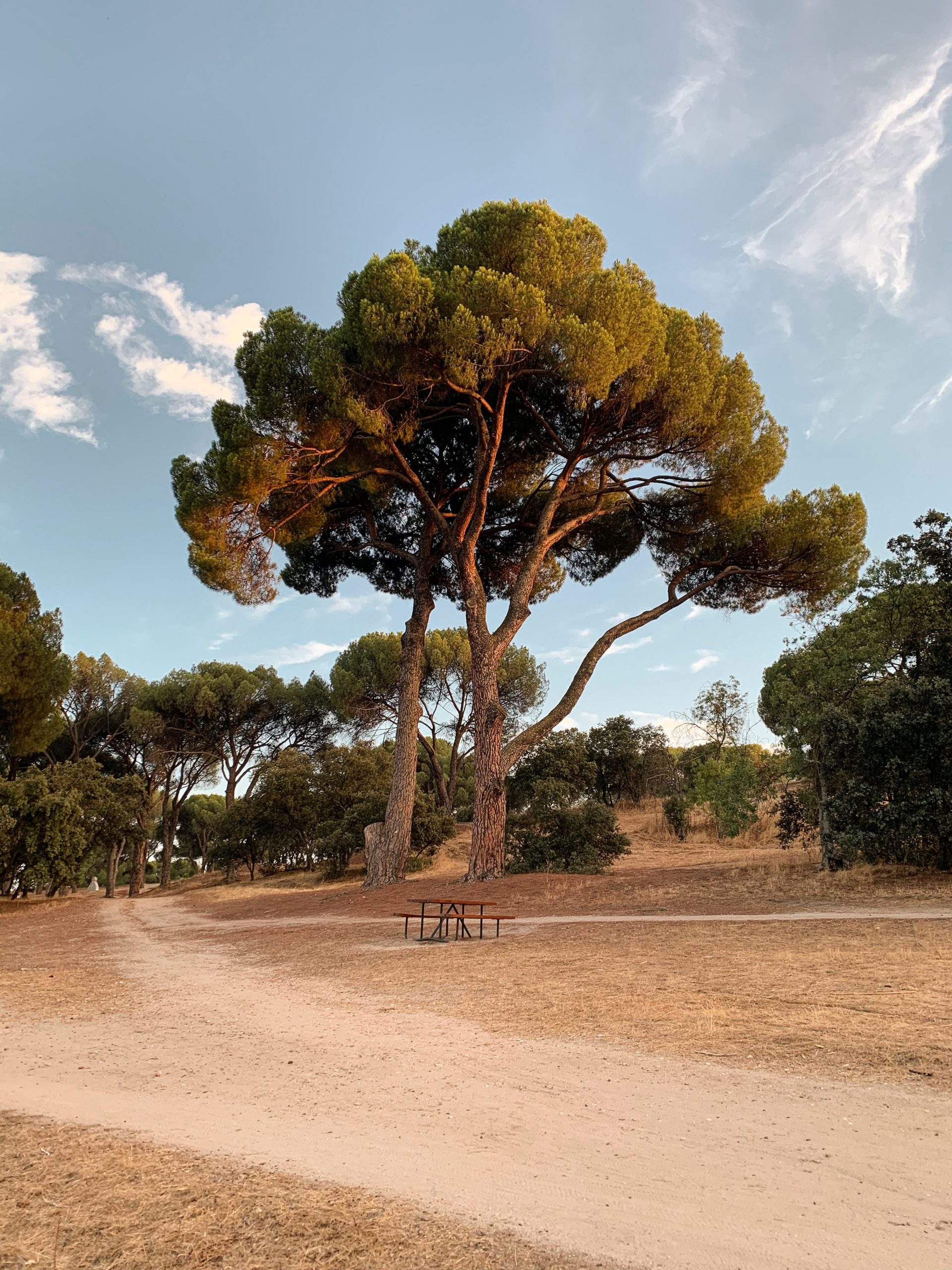
A perfect opportunity to go for a hike in Madrid is Casa de Campo around the big lake. It is super easily accessible by metro and it will not take you long to get there. The whole trail is around 11km long and not too difficult. The only thing you have to consider is some altitude changes every now and then. But, all in all, I think this is an easy and family-friendly hike that you can do if you do not want to go far away from the city.
The views from this hike are very beautiful. The scenery mainly includes the lake, the forest of Casa de Campo, and maybe even some wild animals. Apart from that, it also is a popular biking and working out destination. But, if you are a serious hiker that likes some more action, the following options might be better for you!
How to get to Casa de Campo?
The easiest way to get to Casa de Campo is by taking the metro. There is a metro stop called “Lago”, that leaves you right next to the big lake. From there, you can start walking the “Paseo del Embarcadero” that will take you around the lake.
Admire the beautiful views in Cercedilla
Length of the hike: 10km one way
Difficulty: 7/10
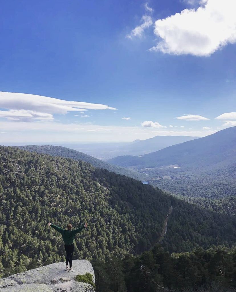
Now, this is a hike that I can definitely recommend to you: Cercedilla is an amazing destination for a hike close to Madrid. It is about an hour by car away from Madrid and offers absolutely idyllic views of the surrounding mountains and forests.
This hike is definitely moderate (and I would not recommend it for children). The change of altitude is quite high (1000m-2000m) and the walks are not always easy. But it is so worth it. Very often people encounter animals on the way, like cows or horses. We were unlucky! Something we did see was snow, which stays at the higher points of the hike even during the warmer months. Having said that, you should definitely take a jacket with you.
The highlight of your hike will be the viewpoint called “Mirador de la Reina”, where you will be able to see the surrounding mountains. That view is spectacular. You will not believe that you are only one hour by car away from Madrid.
The hike starts at a restaurant called “Casa Ciliro”. I picked it to have a clear mark on the map. The last part of the hike is “Puerta de la Fuenfría” point. From there you have two options: You can go the whole way back, or you go the “Camino viejo a Segovia” path back to Cercedilla. When I was there, we just did the same walk back. But I have heard that the “Camino viejo a Segovia” is worth it as well!
How to get to Cercedilla?
Cercedilla is one hour away from Madrid by car. You can go to Cercedilla by train, which is what I would recommend in case you cannot go by car. In that case, take Cercanías C8 from the stop “Pitis”. The whole train ride from Madrid to Cercedilla will only take you one hour.
Hike in El Escorial: Have a birdseye view on the world’s largest Renaissance building
Length of the hike: The marked path on the map is 11km long
Difficulty: 6/10 as we pass some changes in altitude
El Escorial is a very popular one-day trip destination from Madrid. So why not combine this day trip with a beautiful hike?
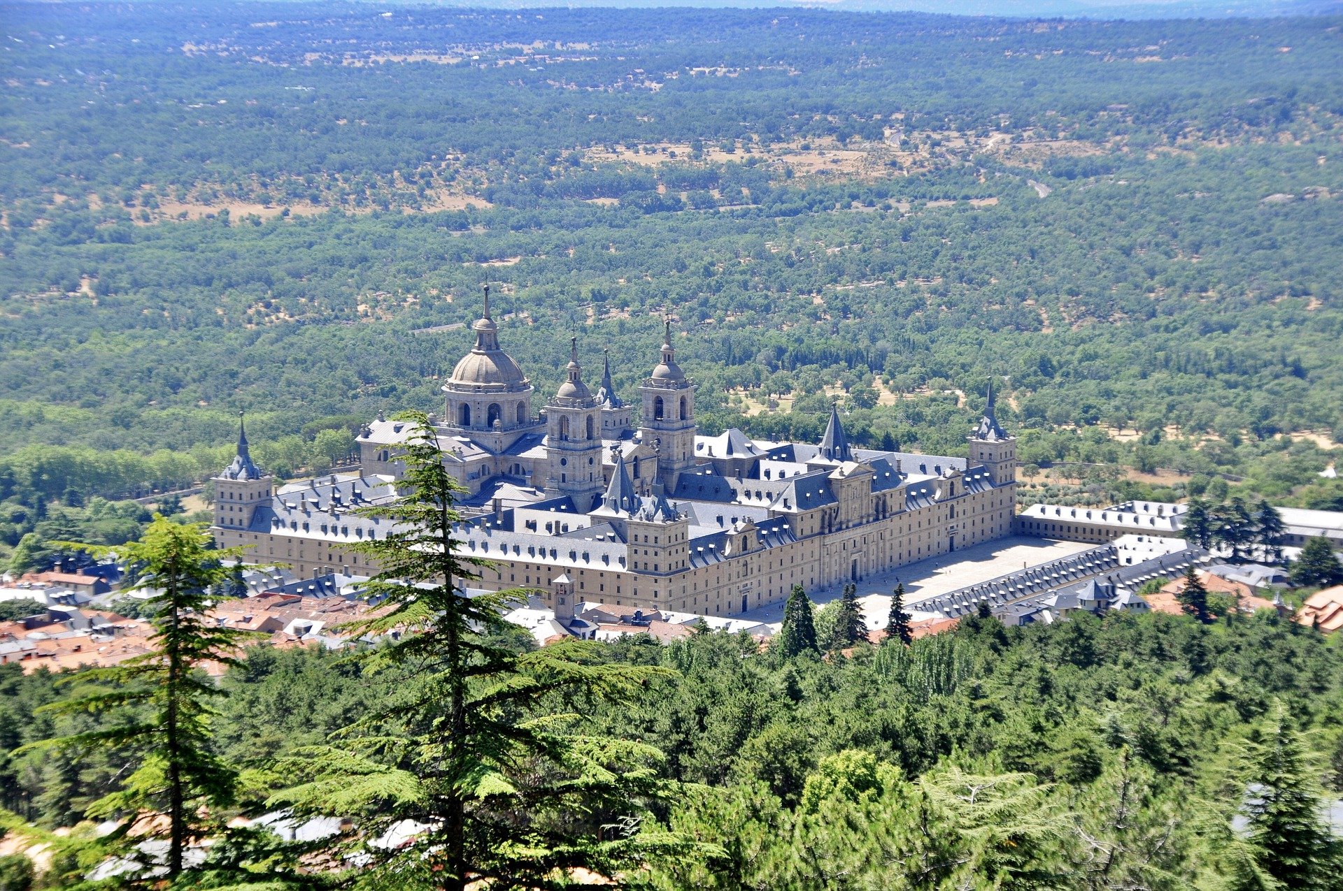
For those, who don’t know what the hype of El Escorial is about, let me explain it to you: The palace of el Escorial is the world’s largest Renaissance building. Yes, you read that right. And it is very close to Madrid which makes it perfect for a little escape from the busy city. First, you can have a tour inside the beautiful palace, look at the museums and find out more about its history. You will already realize El Escorial is surrounded by untouched natural spaces and mountains, which makes it perfect for a hike.
Our hike in El Escorial starts in “Parking El Escorial Monte Abantos”. This is just to make it easier for you to know where to start, and at the same time, a suggestion where you can park your car. But don’t worry, I will tell you how to get to El Escorial by public transport below. From there, we follow the signs saying “Abantos” and keep hiking North. Our first stop is “Mirador Abantos” which offers breathtaking views over the El Escorial palace. Make sure to stop there to take an amazing memory photo. Then, continue walking north and admire the views from the viewpoints, the picturesque forests, and landscapes.
I picked “Pico de Abantos” as a destination for this hike, but if you feel like it, you can keep hiking North. There are some amazing viewpoints to come that I marked on the map. Maybe you will even encounter some wild animals during your hike.
How to get to El Escorial?
Good news! It is super easy to get to El Escorial by public transport. Just take Cernanías C3 from Madrid Chamartín and you will arrive in only 1hour and 20 minutes. If you decide to go by car, you can leave it at the parking lot I suggested above.
See incredible rock formations at Siete Picos (English: Seven Peaks)
Length of the hike: around 16km
Difficulty: 5/10 (I’ve heard people say it is family-friendly, but it is quite a long hike in my opinion)
A very popular hiking destination, that is not too far from Cercedilla, is “siete picos”. Translated to English it means “seven peaks”, referring to the seven peaks of rocks you will see during your hike.
For this route, I chose Restaurante Dos Costillas as the starting point. Firstly, because it is central and easy to find. And you have many parking opportunities around it. Then, you have to look for a sign for “Camino Schmid” (in English: Path Schmid), which you will walk through the first part of the hike. Our next destination is “Fuenta de la Fuenfría”, which is also part of the hiking route in Cercedilla.
The highlight of this trip will be the “Siete Picos” (in English: seven peaks) of rock formations you will get to see during the hike. Apart from that, this tour is widely known for the beautiful views and untouched nature you will encounter during your hike. This hike to the siete picos is circular, so the end of the hike is at the Restaurante Dos Costillas again.
How to get to the Siete Picos?
I would recommend going to Siete Picos by car if you can. Because it is easier to get to Cercedilla by public transport and it’s very close. But if you still want to go by public transport you can take the cercanías Nr. 9 to the stop of “Cotos”. From there, take bus 691 to the stop “Puerto de Navacerrada”.
If you go by car, Puerto de Navacerrada should be your destination. There are several parking lots where you can park your car. Those parking lots tend to fill up quickly, especially during the weekend. That is why I would advise going early, if possible.
Perfect hike near Madrid in Manzanares el Real!
Length of the hike: The hike on the map is a 28 km-long loop
Difficulty: 6/10 as we pass some rock formations and altitude changes. (A great trekking destination!)
Manzanares el Real is another excellent hiking destination not too far from Madrid. And it is very easy to get there by public transport! Check out the instructions below to find out how. Manzanares el Real is a small village with around 8000 inhabitants but it has so much to offer when it comes to hiking.
Apart from that, it is also famous for its castle “Castillo de Manzanares el Real” from the 15th century. It is very well preserved and I would recommend visiting it before you start your hike. There are sooo many different hiking trails in the North from Manzanares el Real.
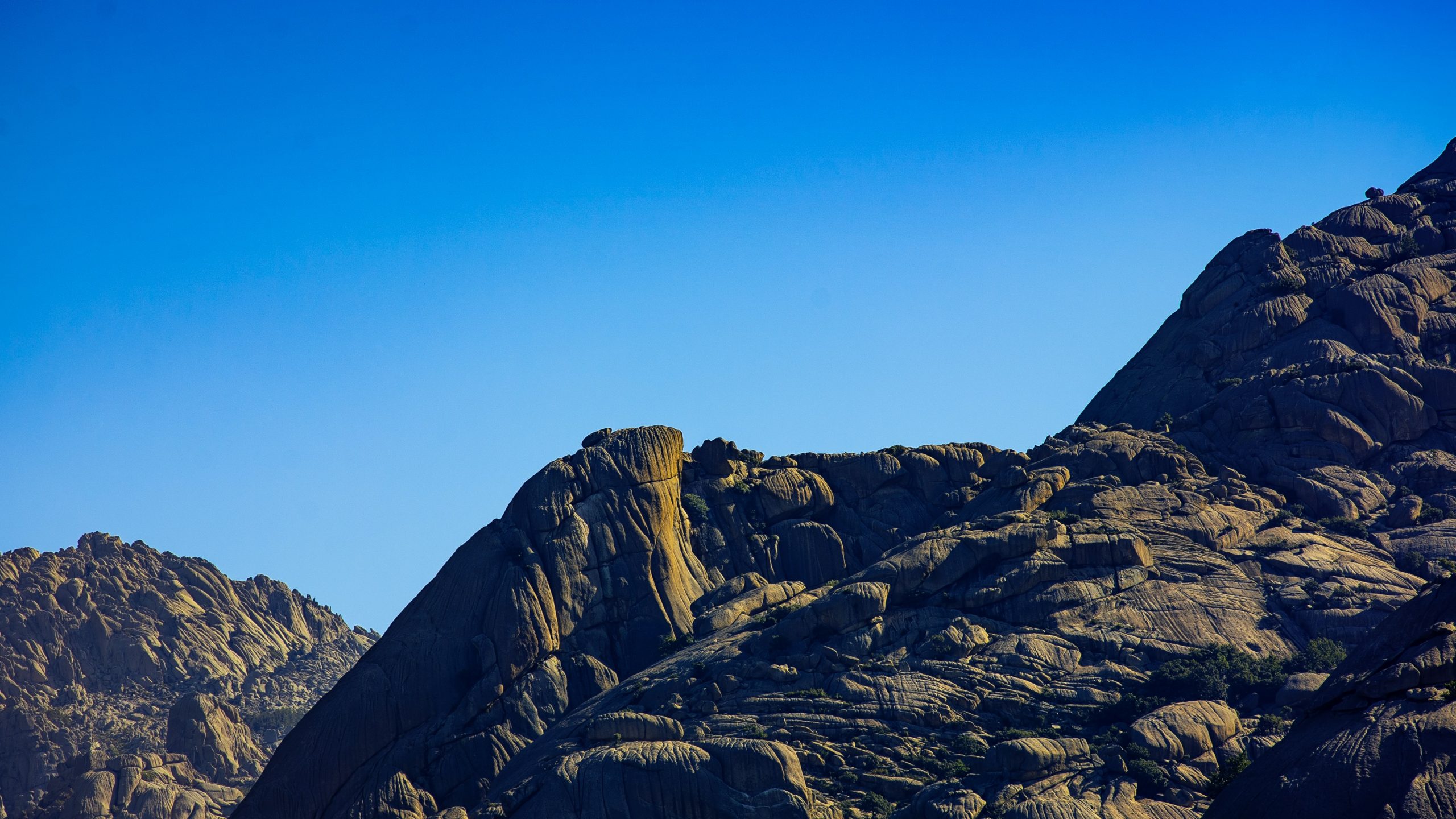
Unfortunately, Google maps does not have all the hiking trails so I marked one circular hike that is 28km long in total. But don’t get scared! There are many other shorter hikes you can take. “Senda Maeso” and “Senda de las cabras” seem to be very popular ones as well. I marked some interesting places you will pass on your hikes. Here, we will pass some beautiful waterfalls, viewpoints, and even CAVES! I do not think you can go wrong with any of these hiking trails. Look at the photo below. The views are incredible!
How to get to Manzanares el Real?
As mentioned before, it is relatively easy to get to Manzanares el Real by public transport. Just take Cercanías C4 from Madrid Chamartín to Tres Cantos. There, change to bus 724 that will take you right to Manzanares el Real. The whole trip will take you a little bit more than one hour and a half. If you decide to come by car, I marked a parking lot on the map where you can park it.
Explore an old monastery and waterfalls in Rascafría
Length of the hike: 11km one way
Difficulty: 5/10
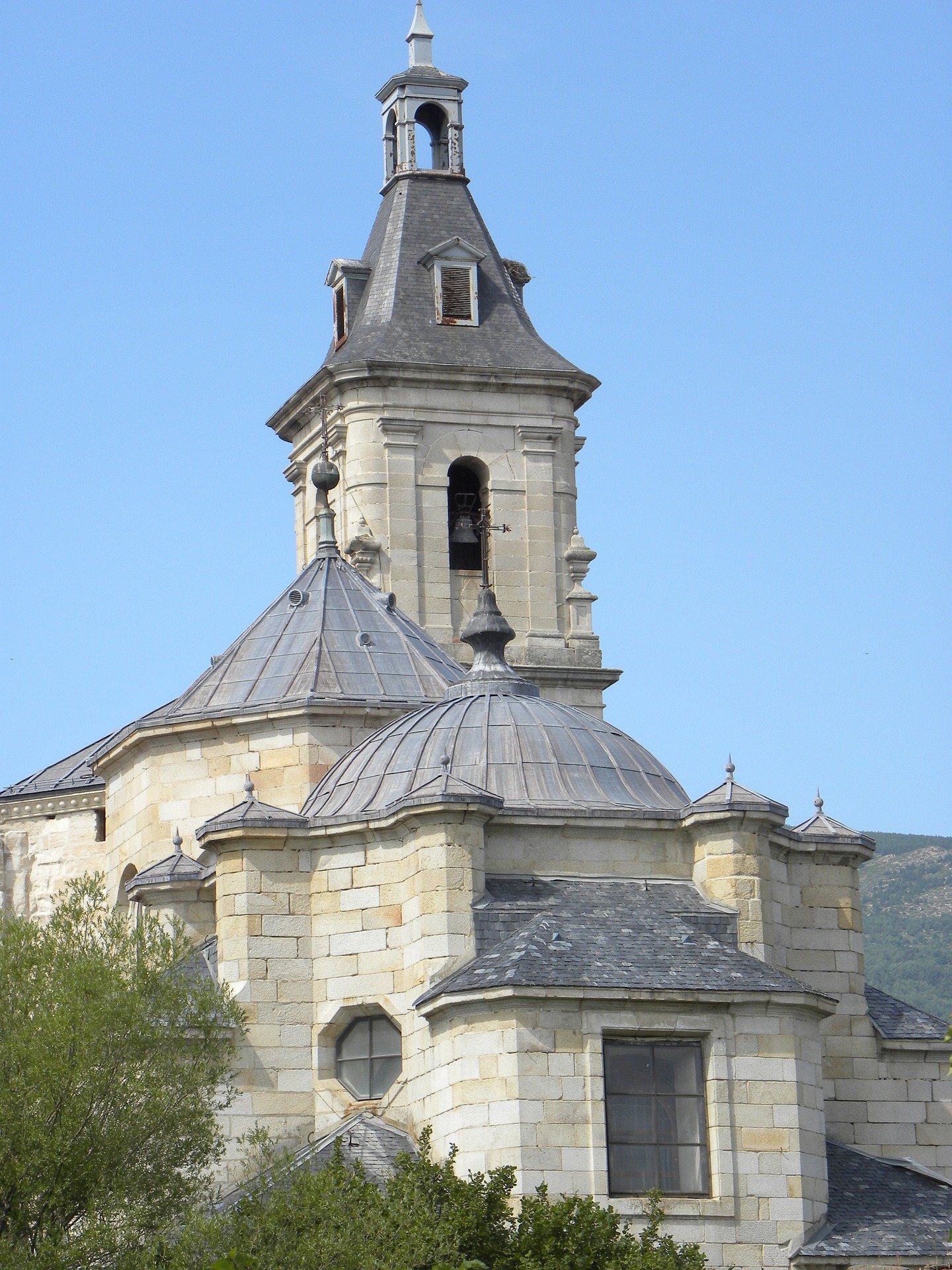
Let’s talk about a hike that is a little bit further away from the city, but is totally worth it: The hike from Rascafría to the monastery El Paular, and then to the waterfall “Cascada del Purgatorio”. So this hike has everything exciting: Beautiful landscapes, an old monastery to visit, and even waterfalls.
This hike starts in a small village called Rascafría. I picked the restaurant “Caldea” as a starting point for this hike because it is central and easy to find. Next to it is a public parking space where you can park your rental car. From there, we will walk the path by the river called “Senda de Rascafría al Puente del Perdón“, which will take us right to the monastery. This monastery was built in 1390 so you can imagine the beautiful architecture it has to offer. At the monastery, I would suggest you have a look inside and check out the museum (book your tickets in advance here). You can have a little break before you hike to the waterfall “Cascada del Purgatorio”. Once you arrive at the waterfalls and spend some time there to relax and reload your energy, get ready. We are hiking all the way back up!
How to get to Rascafría for the hike?
This is the only hike near Madrid where I would recommend going by car. You can take a bus from Madrid but it will take almost 3 hours to arrive. But renting a car is totally worth it! You can park it in the parking lot next to the restaurant “Caldea”, which I mentioned before.
Hike from San Agustín del Guadalix to the lake in Pedrezuela!
Length of the hike: 17km from San Agustín de Guadalix to Pedrezuela
Difficulty: 5/10
One of my favorite hiking routes, and let me tell you why: This hike is not far from Madrid. You can decide if you just want to have a short hike to see some beautiful waterfalls. Or if you want to go all the way from San Agustín del Guadalix to the small town of Pedrezuela. And if you are hardcore, you can continue your hike to the lake of Pedrezuela.
This hike starts in the small town of San Agustín del Guadalix. Here, we picked the restaurant “El Raso” as a starting point because it is central and easy to find. From there, you can walk north to the waterfall “Cascadas del Hervidero”. If you like, you can go back the same way already. But I would suggest continuing your hike on the same street by the river until you pass Azud de el mesto, which is an old dam built hundreds of years ago.
Again, at any point of this route, you can go back to San Agustín del Guadalix, but I would recommend going to Pedrezuela. There, you can have a small break at one of the restaurants. You can even walk around the little village, which is very cute. And if you feel like it, continue your hike to the lake of Pedrezuela. The best part: If you want to go back from your hike to Madrid, there is a bus that leaves in Pedrezuela.
How to get to San Agustín del Guadalix with public transport?
The best part about this trip is: It is very easy to get to San Agustín del Guadalix with public transport. You just have to take bus Alsa 193 from Plaza Castilla that goes to Pedrezuela. Get off at stop “San Agustin – Pol Las Cabezas”, which is right next to the restaurant “El Raso”. You can take the same bus on your way back from Pedrezuela.
And that was it! Those were seven hiking routes not far from Madrid you need to try! Hiking near Madrid is so underrated but I really think Madrid makes a great hiking destination if you just take the time and go to the outskirts. Which destination was your favorite? I think my favorite hiking destination around Madrid is Cercedilla. The views are just incredible!

